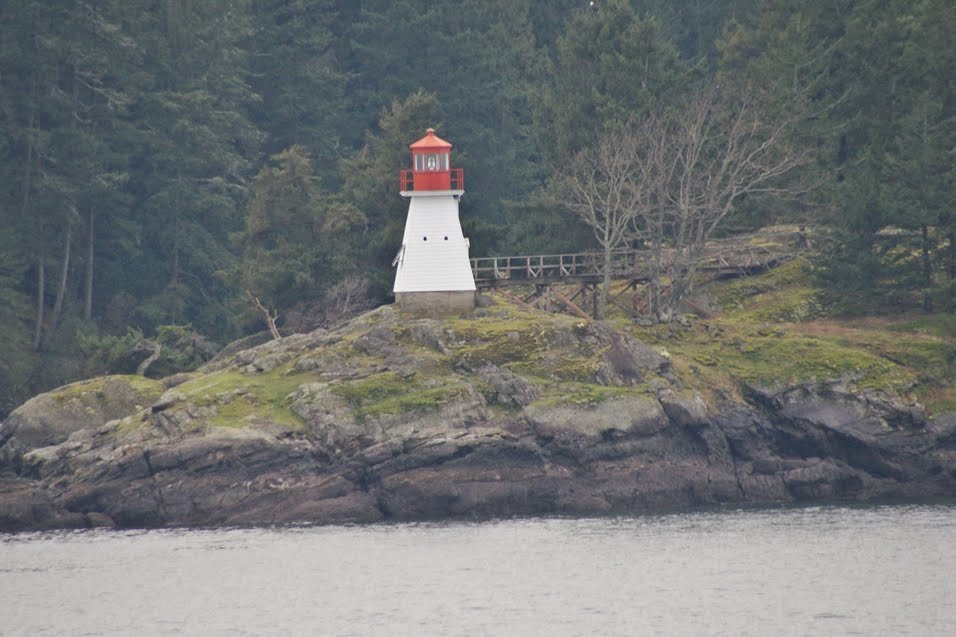
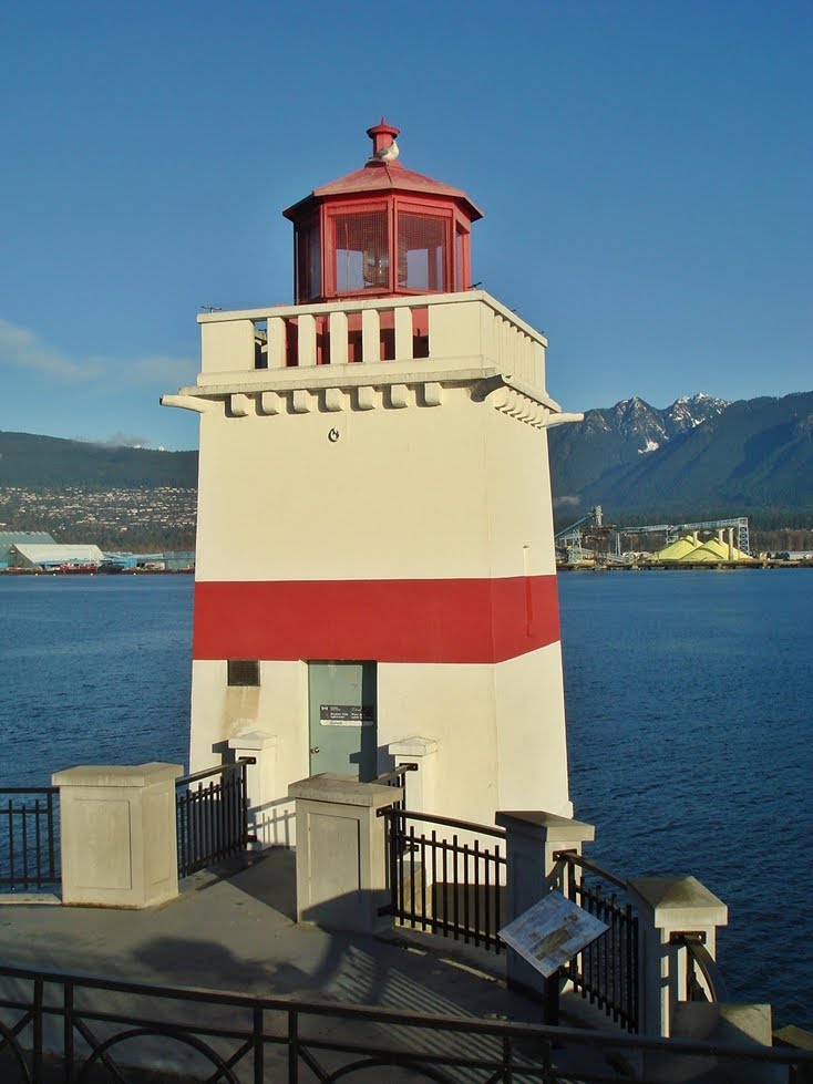
The Race Rocks Lighthouse sits on the Race Rocks a group of rocks just off the Southern coast of Vancouver Island near Sooke, British Columbia. The light station was established there in 1860. It is a 80 foot tall round stone tower painted black and white with a red roof on the light tower. It was restored in 2009. The area around the lighthouse is Race Rocks Marine Protected area and permission is required to land on the island. The light remains an active aid to navigation. The somewhat distant photos were taken in September 2016. Closer photo taken in 2022,
Showing posts with label BC. Show all posts
Sunday, September 25, 2016
Tuesday, June 30, 2015
Chatham Point Light Station, Inside Passage, British Columbia
The Chatham Point Light Station is located at the north end of Discovery Passage approximately 40 kilometres (25 miles) north from Campbell River, B.C. It is where Discovery Passage makes a sharp turn into Johnstone Strait. The station serves as a light station and a weather station and is staffed as of June 2015. The light itself is a white and green cylindrical steel tower on a concrete base and sits in the water off of the shore in front of the station. The station was originally established at this point in 1908. Photos (a bit distant) taken in June 2015.

Monday, June 29, 2015
Scarlett Point Light Station, Port Hardy, British Columbia
The Scarlett Point Light Station sits on the northeast point of Balaklava Island approximately 10 miles north of the town of Port Hardy on Vancouver Island. The station was originally established in 1905. The station remains active and as of 2015 was still a staffed light station. The current tower was erected in 1965 to replace the original tower. Photos (from a distance) taken in June 2015.
Pine Island Light Station, Pine Island, British Columbia
The Pine Island Light Station sits on the southwest side of Pine Island which is near the northeast tip of Vancouver Island north of the town of Port Hardy. The station was established in 1906 and has been active since that time. As of 2015 the station remains one of the few staffed light stations left in Canada. The current cylindrical steel tower was erected in 2001 to replace the original tower. Photo (from a distance) taken in June 2015.
Saturday, May 10, 2014
Port Alberni Lighthouse, Port Alberni, British Columbia
The Port Alberni Lighthouse sits in the harbour at Port Alberni at the head of the Alberni Inlet, a twenty five mile inlet (fjord) that stretches inland from Barkley Sound on the Pacific Coast of Vancouver Island. The lighthouse is active but is privately owned. The lantern is from the original 1981 Chrome Island Lighthouse. The lighthouse was established in 2001. It is owned and maintained by the Alberni Valley Marine Discovery Centre. Photos taken in May 2014.
Whiffin Spit Lighthouse, Sooke, British Columbia
The Whiffin Spit Lighthouse sits at the end of a 1.5 km spit of land that protects the entrance to Sooke Harbour Inlet. There has been a light at this location since @ 1906, but the date of the current structure is not known. The spit is named after a crew member on the Royal Navy vessel 'Herald' that surveyed Sooke Harbour in 1846. The spit, which is a popular place for walks, protects the harbour from breakers coming in from the Strait of Juan de Fuca. This light is an active beacon atop a 21 foot tall cylindrical tower. The site also has a fog signal and a weather station. Photos were taken in May 2014.
Monday, July 9, 2012
Nootka Lighthouse, Yuquot (Friendly Cove), British Columbia
Yuquot, also known as Friendly Cove, is situated at the entrance to Nootka Sound on the West side of Vancouver Island, British Columbia. The location has a long history and was the place that European explorers first had contact with First Nations peoples in what is now known as British Columbia. Friendly Cove is the traditional home of the Mowachaht peoples. Both the Spanish and British explored the area, with Captain James Cook being the first in 1778. The Spanish established a naval post here for a number of years prior to 1795. The Spanish and the British squabbled over ownership but both eventually abandoned the site after the signing of the 3rd Nootka Convention and the Mowachaht peoples reoccupied the cove. In 1906 the local store keeper established a light at the site to assist mariners entering the sound. A petition was sent to Victoria, the capital of British Columbia requesting a light be built on the site and in 1910 construction began with the light being turned on in March 1911. Today it remains as one of the few remaining staffed lighthouses in Canada. I visited the site on a day trip aboard the Uchuck III, a working coastal vessel that also takes tourists to some of the remote places in Nootka Sound. The Uchuck III is a wooden hulled converted American Yard Minesweeper (1942). In addition to visiting the Nootka Lighthouse, the visit to Yuquot also afforded me the opportunity to learn some of the history of the Mowachaht/Muchalaht people. Friendly Cove was declared a National Historic Site by the Canadian Government in 1923 and the signifance of the First Nations history was further recognized in 1997. The photos were taken in July 2012. Many thanks to Joanne and Mark the resident lightkeepers for their hospitality. It was great to hear first hand a bit about the lifestyle of lightkeepers.
Sunday, August 28, 2011
Merry Island Lighthouse, Merry Island, British Columbia
Wednesday, January 26, 2011
Trial Island Lantern House, Maritime Museum of British Columbia, Victoria, B.C.
This lantern house was originally installed on the Trial Island Lighthouse, four miles SE of Victoria, British Columbia on November 16, 1908. The apparatus was replaced by an acrylic lens in 1970. The lamp is a Fourth order Fresnel lens and when in operation was visible for fifteen miles. It is currently displayed outside of the Maritime Museum of British Columbia in Bastion Square, downtown Victoria, B.C. Photos taken in January 2011.
Portlock Point Lighthouse, Prevost Island, B.C.
The Portlock Point Lighthouse is located on the Eastern end of Prevost Island in the Gulf Islands of Southern British Columbia. The station was established in 1896 and was automated and destaffed in 1969. It can be seen from the British Columbia Ferrys on the Tsawwassen (Vancouver) to Swartz Bay (Victoria) route as well as several Gulf Island routes. These photos were taken in January 2011.
Wednesday, December 8, 2010
Light Identified - Finally - Roberts Bank, British Columbia
I have finally been able to identify the light that I had previously dubbed "Sand Heads II". It is actually the Roberts Bank RACON (Radar Beacon) and is located in the Strait of Georgia at Latitude 49.087 and Longitude 123.308. It is accessible by boat and is found Southwest of the Sand Heads Light. The original post can be found here.
Monday, June 21, 2010
East Point Light, Saturna Island, B.C.
The East Point Light is located on the far Eastern tip of Saturna Island, one of British Columbia's beautiful Gulf Islands. It sits across Boundary Passage from the Patos Island Light in Washington's San Juan Islands. The station was established on the site in 1888. The original lighthouse was replaced by a steel tower in 1948 and the station was destaffed in 1966. Photos taken in June 2010.
Wednesday, December 16, 2009
Prospect Point, Vancouver, B.C.

As with the recent post of the Brockton Point Light, here are views of the Prospect Point Light which is in Stanley Park, Vancouver, B.C. and sits under the Lions Gate Bridge. The original station was established here in the late 1800's, however the age of the current light is not known. Photo from the water taken in August 2009 the other photo taken in 2008.
Saturday, November 28, 2009
Saturday, September 12, 2009
Distant Views - Scarlett Point and Triple Island, B.C.
On a cruise to Alaska, I was able to take a couple of distant shots of two of British Columbia's manned lighthouses. The one on the right is the Scarlett Point Lighthouse, which is on Balaklava Island, North West of Port Hardy, B.C. (Northern Vancouver Island). The one on the left is the Triple Island Lighthouse which is in Brown's Passage, twenty five miles West of Prince Rupert, B.C. Hopefully one day I can get closer shots of these two stations.
Sunday, August 30, 2009
Sand Heads II, Strait of Georgia, B.C.
When out photographing the Sand Heads Light, I noted this structure about a mile South in Georgia Strait. I am not sure of it's proper designation and will be attempting to learn more about it. Photos taken in August 2009. In the bottom photo you can see its location in proximity to the Sand Heads Light (the white speck on the right).
Sand Heads Light, Steveston, B.C.
This automated station is located at the entrance to the South Arm of the Fraser River at the end of a long rock jetty (breakwater). The station was believed established in 1913. Photos taken in August 2009. Thanks to my friend Darry for taking me out in his boat to photograph this light. The village of Steveston is located in the City of Richmond, B.C. which is just South of Vancouver
Monday, July 27, 2009
Ogden Point Lighthouse, Victoria, B.C.
The Ogden Point Lighthouse is located at Ogden Point in the James Bay area of the city of Victoria, British Columbia. The light sits at the end of a long breakwater and overlooks the entrance to Victoria harbour. The light was established in 1917. The breakwater is a popular place for walks on a sunny day. Photos taken in July 2009. In one of the photos the ferry to Port Angeles, Washington is seen leaving the harbour.
Sheringham Point Lighthouse, Shirley, B.C.
The Sheringham Point Lighthouse is located on Vancouver Island, British Columbia, Northwest of Victoria, at Shirley, B.C. It is the most Southerly of the lighthouses that are found on what is known as the West Coast of Vancouver Island. The light was established in 1912 and the original lens was replaced by a revolving beacon in the 1970's. The government and the Sheringham Point Lighthouse Preservation Society are attempting to work out arrangements for the society to preserve the site. The area adjacent to the lighthouse is being developed into large building lots. Photos taken in July 2009. The Society website is found at: http://www.sheringhamlighthouse.org/splps/
Subscribe to:
Posts (Atom)